Native Angeleno who has worked in public, academic and special libraries, as well as museums and college instruction. I am responsible for maintaining the Metro Transportation Library website, all of our social media properties, and digitization efforts to bring more of our resources to our users whenever they need them. For more information, visit The Metro Library website.

Monday, July 26, 2010

A.D.A. Turns 20: Transportation And The Americans With Disabilities Act

Image via Flickr

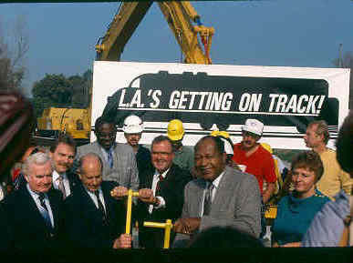
While everyone was celebrating the 20th anniversary of rail in Los Angeles last week, another important anniversary was approaching without much fanfare: the Americans With Disabilities Act Of 1990.

Twenty years ago today, the ADA was signed into law by President George H.W. Bush. This legislation prohibits, under certain circumstances, discrimination based on disability, which it defines as "a physical or mental impairment that substantially limits a major life activity."

Public transportation is certainly a major life activity. Title II of the ADA covers Public Entities (and public transportation). While the full text of the legislation can be found here, and the preamble addressing Transportation for Individuals With Disabilities is found here, we wanted to mark this occasion by sharing some valuable resources regarding the ADA and transportation.

Our website provides you with An Approach To Transportation Research, a step-by-step guide to finding information on just about any subject related to our interdisciplinary field of study. After reviewing this suggested "roadmap," it is worthwhile to explore additional tools on our Library Research webpage.

Of course, a wealth of information can be found in online databases. The first place to search for the latest resources would be TRIS, the Transportation Research Information Services database. The 340 items currently found in a keyword search of "americans disabilities act" are automatically sorted in reverse chronological order, providing you with the most recent resources first.

Numerous resources in the National Transportation Library catalog have full-text links as do NTL's Digital Repository and other transportation websites providing online access.

The Metro Transportation Library's vast collections hold numerous items related to ADA. Beyond our own library, the database for the WorldCat online catalog of networked institutions shows at least 720 titles addressing the subject of ADA and transportation as of today. Once you enter some brief information about your location, you can find which libraries near you have the titles you want (or you may use this information to initiate an inter-library loan with a participating library).

In addition to these primary resources, several websites offer information on ADA as it relates to transportation.

The United States Access Board is an independent federal agency committed to accessibility for people with disabilities. Created in 1973, it predates the Americans With Disabilities Act Of 1990 by many years and is now a leading source of information on accessible design.

The ADA Standards For Transportation Facilities became effective in November, 2006. They apply to the construction and alteration of transportation facilities.

The Easter Seals Project Action project promotes universal access to transportation for people with disabilities under federal law and beyond by partnering with transportation providers, the disability community and others through the provision of training, technical assistance, applied research, outreach and communication.

For practical implementations of the ADA, under the sponsorship of the Transit Cooperative Research Program (TCRP), the Transportation Research Board (TRB) prepares syntheses of current practice in the transit field. Many of these reports, prepared by consultants with expertise and assisted by a technical panel, have dealt with ADA issues. They include:

ADA Paratransit Eligibility Certification Practices
Paratransit Contracting And Service Delivery Methods
Communicating With Person With Disabilities In A Multimodal Transit Environment
Use Of Rear-Facing Position For Common Wheelchairs On Transit Buses
Practices In No-Show And Late Cancellation Policies For ADA Paratransit

If we stop to look around today at all that has been done to increase accessibility (sidewalk curbs that now have ramps, elevators with braille, buses with wheelchair lifts, etc.), we have to pause and think about the impact these actions have had on so many lives.

Last week, U.S. Secretary of Transportation Ray LaHood wrote:
There was certainly no lack of vision from the policymakers, advocates, and citizens that fought to pass the Americans with Disabilities Act in 1990. And it's equally important that we don't suffer from a lack of vision now. DOT is committed to doing its part.

The bottom line is this: we recognize that our systems of transportation are about much more than just getting around. They are avenues that connect people with the chance to achieve their dreams.

Our challenge is to make sure that everyone has access to the most fundamental of American rights - to dignity, independence, security, and opportunity. And the Department of Transportation fully intends to meet that challenge head on.

Wednesday, July 21, 2010

Information Innovation: Metro Transportation Library Leads The Way


Brigham Young University plugs their library service by capturing potential users' attention through a parody of the popular Old Spice commercials, via YouTube

An old axiom in libraries is that when the economy goes down, library patronage goes up. Therein lies the challenge: responding to the need for information (and keeping the doors open) when resources are stretched thin or disappearing altogether.

A new fiscal year is under way, and libraries in the current economic recession are feeling the pinch like never before. In addition to the expected call for traditional "core" services to continue, other users want libraries, whether they are public, academic or specialized, to embrace new technology, products and services.

The American Library Association reports a "perfect storm" of growing demand for library services and shrinking resources to meet that demand as state and local jurisdictions cut funding, often several times in the same fiscal year.

In the face of cuts in service, hours of access, and budgets, we wanted to highlight and celebrate the efforts of those who are working hard to respond to these challenges. Innovative efforts, both local and large-scale, are not only addressing user needs, but are now more easily shared with and replicated by other institutions.

NPR is quite optimistic, reporting yesterday that libraries are poised to be "the next big pop-culture wave." It's a refreshing take on the current state of providing information, so it's a good time to review some of the enormous challenges facing every type of library as well as our own activities and accomplishments.

Each April during National Library Week, the American Library Association releases their State Of American Libraries report. The 2010 report and other current research detail some ominous findings and trends, including:

71% of public libraries provide their community's only free public access to computers and the Internet, and one-third of Americans over age 14 used a public library computer or wireless network to access the Internet last year. One can't overestimate how many library computer users are searching for a job

96% of Americans feel that school libraries are an essential part of the education experience, yet entire school districts (including many large ones) are choosing to entirely dismantle their school libraries

90% of college students regularly turn to libraries for their online scholarly research databases and course-related research, as these resources provide credible content, in-depth information, and the ability to meet instructors' expectations, but academic libraries find it difficult to maintain their leading role in digitization efforts to provide unprecedented access to millions of volumes in the face of severe budget cutbacks


American Library Association President Jim Rettig notes that "As illustrated in the ALA's State of America's Libraries report, in times of economic hardship, Americans turn to -- and depend on -- their libraries and librarians."

Our public, academic, and specialized libraries are thinking outside the box to meet their growing needs. Libraries are increasingly taking access to their collections and services to where their users are. For some, this means access to their websites and online catalogs via smart-phones and other mobile devices. Libraries have incorporated catalog-search widgets into their Facebook page. We made our online catalog of over 45,000 items in our collection accessible via smart-phone last year.

For others, this means taking the physical collections out of the traditional building to where their users live, work and play. Libraries are starting to fight back against unconventional competition from Amazon and Netflix by putting libraries in the path of the customer, in places such as supermarkets.

Slate recently reported on libraries getting a "mall makeover." In Dallas, one of these "in-your-face" shopping center locations circulates more material than a traditional branch library eight times its size.

In Northern California, Contra Costa County Library promotes "Library-A-Go-Go" service that includes not only a shopping center location, but two automated book-dispensing machines at Bay Area Rapid Transit (BART) stations.

As a governmental institution, The Metro Transportation Library's primary user audience is Metro employees. We have been a leader not just in the transportation library community, but in leveraging rapidly evolving technology to continue and improve service in any number of ways.

We were the first MTA department to provide internet access to employees, to launch an MTA intranet site, to start a blog (Los Angeles Transportation Headlines in 2006, and still going strong), to dive into social networking (our Facebook and Myspace pages), to create a YouTube video channel, build a Flickr photo-sharing site and the first MTA tweets came from the Metro Library Twitter account (1,300 followers and growing) . We have been at the forefront of sharing information in innovative ways, launching MTA's only Scribd document-sharing site and virtual representation of Metro in Second Life.

As we move forward in this new fiscal year, we will look at how best to both serve our audience and remain a leader in the transportation library community, while adapting to the rapidly changing technology and other challenges around us.

We will continue to harvest born-digital documents to capture them before they disappear from the Internet. We will scan and store rare and fragile archival resources to preserve them for generations to come. We will continue to provide both access and findability as best we can, so that our users can get what they want, when they want it, in methods and formats most convenient for them.

Most of all, we will continue to collect, preserve and make accessible those resources that will help Metro succeed in its ambitious mobility agenda for the entire region. We do this because we are committed to our profession's incredible ability to not just survive in tough economic times, but to thrive as well.


Resource List:

Opportunity For All: How The American Public Benefits From Internet Access At U.S. Libraries (212p. PDF : University of Washington Information School, Bill & Melinda Gates Foundation, Institute of Museum and Library Services, April 2010)
Opportunity For All: Research Brief

Libraries And The Recession, American Library Association, April, 2010

"Libraries Get A Mall Makeover," Salon, July 6, 2010

"Libraries Focus On Convenience With Mall Locations," Associated Press, July 6, 2010

The State Of America's Libraries Annual Report (66p. PDF), American Library Association, April, 2010

"Toward A New Alexandria: Imagining The Future Of Libraries," The New Republic, March 12, 2010

Why The Next Big Pop-Culture Wave After Cupcakes Might Be Libraries, NPR, July 20, 2010

Thursday, July 15, 2010

Research Roundup: High-Speed Rail, Transportation Statistics, Transportation Taxes

We want to periodically highlight current transportation and transit research that is particularly useful or timely. Several new reports were issued recently that caught our eye and deserve review in addition to inclusion in our daily Transportation Headlines.

Image via California High-Speed Rail Authority

HIGH-SPEED RAIL

Is high-speed rail in California not only viable, but a worthwhile investment? It depends on who you ask. Two recent reports (not to mention numerous newspaper articles and editorials) have vastly different takes on the subject.

The UC Berkeley Institute of Transportation Studies recently released its Review Of "Bay Area/California High-Speed Rail Ridership And Revenue Forecasting Study" (59p. PDF). They conclude that the California High-Speed Rail Authority's forecasts of demand and ridership for a new San Francisco-to-Los Angeles high-speed train are not reliable because they are based on an inconsistent model. They believe that average ridership projections were flawed at key decision-making junctures and that it is impossible to predict whether the proposed system will experience either healthy profits or severe revenue shortfalls.

This study's findings had a strong impact in that it was the first academic review of the rail authority's ridership forecasts, which were part of California's successful application for $2.25 billion in federal stimulus funds. An overview of the key problems highlighted in the report can be found in this UC Berkeley Press Release.

Rendering for Anaheim Regional Transportation Intermodal Center (ARTIC) via Flickr

Meanwhile, the CalPIRG Education Fund also published a report in the past few weeks with a much different view. Next Stop: California -- The Benefits Of High-Speed Rail Around The World And What's In Store For California (47p. PDF) presumes that the system will be built and proposes that the state will reap great benefits from its investment. CalPIRG finds that dramatically-reduced travel times, lower energy consumption, environmental benefits, high-speed rail's safety record, and the potential for job creation and economic gains are all reasons to forge ahead and enjoy the great successes that so many other countries have had with high-speed rail.

Image via Flickr

RESEARCH STATISTICS

The most recent edition of State Transportation Statistics (2009) was released last week. This is an invaluable research tool if you are looking for information regarding infrastructure, safety, freight transportation, passenger travel, vehicle registration, vehicle-miles traveled, as well as statistics related to economy, finance, energy and the environment.

Whether you need to find out something rather basic such as how many miles of public road there are in the United States (4.04 million) or something more obscure such as the states with the highest and lowest percentage use of safety belts by drivers and front-right passengers (Hawaii 97%, Massachusetts 67%), it's probably in there. The entire report (143p. PDF) contains 112 tables of data for every state and is available only online starting with the 2009 edition this year.

It's an enormous effort - how do they compile such comprehensive statistical data? The Research and Innovation Technology Administration (RITA)'s Bureau of Transporation Statistics (BTS) provides this Information On Data Sources Document that is intriguing in and of itself.

Image via Flickr

TRANSPORTATION TAX

The Mineta Transportation Institute recently issued the results of a national survey titled: What Do Americans Think About Federal Transportation Tax Options?: Results From A National Survey.

The survey, conducted this Spring, tested public support for sales taxes, gas taxes, and mileage taxes that would raise revenue for transportation purposes. Eight different scenarios were proposed, with the half-cent sales tax garnering the most support (43%) and a 10-cent increase in a gas tax (42%) to reduce global warming. Half-cent sales tax most palpable? Worked for Los Angeles County's Measure R in 2008.

Respondents were least receptive to a 1-cent per mile mileage tax (21%) and a 10-cent increase in the gas tax that was not earmarked for a specific purpose (23%). The survey found that linking a transportation tax to environmental benefits increased public support. The Research Brief provides a nice summary of the findings.

Wednesday, July 14, 2010

History Pin: Google In Partnership To Take On "Augmented Reality" & Map The World's Photos And Stories

Image via Information Aesthetics

We recently highlighted The Museum of London's efforts to create an augmented reality iPhone app from a set of geotagged images in their collection. With the images plotted on a Google Map, history comes alive as the metadata for each image tells a story when old images are superimposed on the user's location.

Now comes word of a much larger project in the same exciting vein: History Pin, a partnership between Google and We Are What We Do, hopes to become the largest user-generated archive of the world's historical images and stories.

The website serves as a digitized, interactive visual time-machine. Users upload their own photos along with the stories behind them. The photos are then plotted to an interactive map and layered onto current street view scenes, providing geo-located portals to the past.

Watch a fascinating overview of the project here:


How does such an ambitious project come into being? With a dream. The History Pin website boils down the story this way:

We Are What We Do's big new campaign aims to get people from different generations to spend more time together. It became obvious that old photos are a great way of gathering people together and getting them chatting.

We wanted people to dig out, scan, upload and pin their photos and stories to a map of the world for everyone to see. So we decided to call Google and ask if they'd help. They had a map all ready for us to use and happened to have photographed most of the world...which was handy.

So, should we regard this as just technology for technology sake, "because they can?" Not if you care about statistics clearly illustrating that inter-generational communication (which We Are What We Do cares so much about) is rapidly on the decline.

People of different age groups spend a lot less time together than they used to. In Britain, only 10% of elderly people live with their children, compared to 40% just 50 years ago. In an age where 90% of teenager communication is digital, the trend may only lead to different age groups living in completely different social worlds. A study from the Pew Research Center's Internet & American Life Project regarding Generational Differences In Online Activities highlights stark disparities in how different age groups are interacting with technology today.

A project like History Pin has something for everyone and could serve to bridge those gaps. We believe that the vast visual resources of libraries and archives could contribute greatly to this type of endeavor and serve as a driving factor behind widespread adoption of it as well.

Everyone has old photos, but is there a larger payoff for contribution besides a sense of community and belonging? It remains to be seen - but with Google behind it, History Pin could be the Flickr of 2011.

Regardless, we have to admit that with crowdsourcing, resource sharing, social networking, mobile applications and Learning 2.0 all in one product, it doesn't get any more "New Media" than that!

Going forward, old photographs might stop gathering dust and could begin gathering interaction, conversations and new relationships instead.

An in-depth presentation of how to use History Pin can is presented here:

Monday, July 12, 2010

Blue Line At 20: Welcoming The First Metro Rail Project And Its Continued Success

"Past The Banner Threshold Into A New Rail Era For Los Angeles" from September 1990 Headways

As we discussed last week during our look back at early rail links between Los Angeles and Long Beach, Wednesday is the 20th anniversary of the Metro Blue Line.

When the light-rail cars began rolling on Saturday, July 14, 1990, nearly 30 years had passed since the last Pacific Electric Railway car went out of service. In that time, the population of Los Angeles County had grown by approximately 50%.

The congestion, reduced travel times, air quality, and other factors contributed to a warm welcome for renewed service between 22 stations on a 22-mile long route between the two largest cities in the County.


Officials from both the SCRTD and Los Angeles County Transportation Commission had predicted daily ridership at about 5,000 during initial stages of operation.

During the first two weeks after the grand opening, more than 600,000 people rode the Blue Line, including 32,000 on the first day of service, and nearly 70,000 on the second day (a Sunday).

Five years after groundbreaking, the Metro Blue Line began moving people along its 22-mile route.


The inaugural run left the tunnel under Flower Street in downtown Los Angeles and pulled into Pico Station a few minutes later. The dignitaries on hand included California Lieutenant Governor Leo McCarthy; Los Angeles Mayor Tom Bradley; Los Angeles County Supervisors Ed Edelman and Kenneth Hahn; SCRTD Board President Nick Patsaouras; SCRTD General Manager Alan Pegg; and Los Angeles County Transportation Commission members Christine Reed and Jacki Bacharach.

That first Blue Line train picked up additional dignitaries along the way. At 103rd Street Station in Watts, Los Angeles City councilwoman Joan Milke Flores and County Supervisor Kenneth Hahn were featured speakers. Mayors Walter Tucker of Compton, Robert Henning of Lynwood and Thomas Jackson of Huntington Park boarded the train at Compton Station. Carson's mayor Vera DeWitt joined the festivities at Del Amo Station, while Long Beach mayor Ernie Kell and Long Beach councilman Ray Grabinski joined in at Willow Station.


1991: Good Morning America interview with Neil Peterson, Executive Director of the County Transportation Commission regarding the Blue Line's first anniversary, the long-range transportation plan, and the mythology of General Motors' involvement in dismantling the Pacific Electric streetcar network.

The "Blue Line" was also the name given for a light rail line between Los Angeles and Pasadena. Work began on this line as early as 1994, but was suspended following a County ballot initiative, which banned use of taxpayer money on subway construction. After legislation passed creating a separate construction authority to continue work on this line, it was dubbed the "Gold Line."

For the 10-year anniversary in 2000, Metro Blue Line rail cars were disguised as modern-day Pacific Electric "Red Cars," in a nod to the historic rail service that ran through the region in the early 20th century. After 10 years, the Blue Line had served more than 135 million passengers with sustained average weekday boardings of 63,000.

The Metro Blue Line remains the longest rail line in the Metro system, and the one with the most stations. The Blue Line not only paved the way for the rest of the Metro Rail system, but had its own starring role in at least two movies. In the 1995 film Heat, the opening sequence shows one of the main characters alighting at Firestone Station. In the 2003 film The Italian Job, the main characters drive their BMW Mini Coopers into the 7th/Metro Station and manage to cut all power in order to stop an oncoming train.

The vision, hard work and dedication of countless transportation advocates, employees and elected representatives created the Blue Line and made it a success. Its entire $877 million in funding came from state and local sources.

Los Angeles Mayor Tom Bradley at Blue Line Groundbreaking at Carson Shops, October 31, 1985 (Metro Transportation Library Flickr)


Rail Operations Team prepares for Blue Line Opening (Current Metro CEO Art Leahy is standing at far right) from August 1990 Headways

Additional Resources:

Photos
Metro Transportation Library Blue Line Flickr Photo Set

Videos
Metro Transportation Library YouTube Channel

Employee News Magazine Stories
Headways, August 1990
Headways, September 1990

Planning Documents
Concept Design Report: Executive Summary (September, 1983)
Concept Design Report: Volume 1 (September, 1983)
Draft Environmental Impact Report: Summary (May, 1984)
Draft Environmental Impact Report (May, 1984)
Draft Environmental Impact Report: Design Appendix (May, 1984)
Draft Supplemental Environmental Impact Report (December, 1984)
Final Environmental Impact Report (1985)

Thursday, July 8, 2010

Blue Line At 20: Looking Back At Early Service Between Los Angeles And Long Beach (1902-1961)

Pacific Electric Railway On First Day Of Operation to Long Beach, July 4, 1902 (via Metro Library Flickr)

Next week, Los Angeles' first contemporary rail project turns 20 years old. The Metro Blue Line running between Los Angeles and Long Beach opened on July 14, 1990, but rail service linking the two cities stretches back more than 100 years.

We wanted to take a look back at the first complete interurban link built by Henry Huntington, one of the most successful in the entire system, and the last to be abandoned and replaced with bus service.

The line connecting downtown to Long Beach was first proposed at a Los Angeles City Council meeting on June 24, 1901. Henry Huntington had planned to build a resort hotel in Long Beach, and settlers there wanted more connection to Los Angeles than the existing six to eight steam trains per day provided by Southern Pacific, which had replaced horse-drawn cars in 1888.

Long Beach was a burgeoning community at the turn of the last century. In 1890, Long Beach had only 484 residents. The population grew to over 2,000 people in 1900. By 1910, Long Beach's population had grown to 17,000 - making it the fastest growing city in the United States during that decade. This rapid growth was attributed to the convenience of trolley travel to Los Angeles, and by 1920, the population had expanded to over 55,000.


Early photo of Pacific Electric service to Long Beach pier (via Metro Library Flickr)

The City of Long Beach noted the success of interurban lines built to Santa Monica and Pasadena, and the City Fathers agreed to offer a franchise for rail service. The proposal called for tracks to enter the city along American Avenue (later renamed Long Beach Boulevard). This was appealing in that streetcars would be routed just three blocks from the town's small business district. However, strong opposition came from those who did not want more tracks along their seaside property, as plans called for tracks to run along Ocean Park Avenue (later renamed Ocean Boulevard), a street lined with upscale residences.

A representative for Henry Huntington successfully bid $9,600 the franchise. The citizens of Long Beach were generally pleased despite not knowing the final track routing, as the large sum of money would help balance the municipal budget.

The area between Los Angeles and Long Beach was generally flat and uninhabited farm and ranchland, allowing the tracks to be laid quickly. The largest settlement between the two cities was Compton, population 452. Trackwork was indeed completed ahead of schedule and interurban cars borrowed from the Pasadena and Alhambra lines were put into service until new cars could be received for the Los Angeles - Long Beach line.

July 4, 1902: On the first day of service, Long Beach's 2,000 residents saw 30,000 visitors by afternoon. Most came by rail (with new arrivals every 15 minutes), but many joined the holiday festivities by buggy and carriage. Some visitors who arrived by steam train were so enamored of the new Pacific Electric line that they sacrificed their return tickets so they could ride the festive Red Cars back to Los Angeles.

By the 1920s, the Automobile Era was well underway in Southern California. Expanded development, car ownership and new roads translated into more grade crossings and hazards for streetcars, increasing their travel time. Buses held appeal for transit operators as a cheaper transportation mode: employee overhead was lower and the high expense of railcar maintenance plants could be avoided.

With the arrival of the Arroyo Seco Parkway, the nation's first "super highway," in 1939, the writing was on the wall for cars and buses to challenge streetcars as the preferred method of travel.

Pacific Electric Cars on Ocean Boulevard, Long Beach, March 1936 (via Metro Library Flickr)

By the 1940s, Los Angeles had grown greatly in both size and population. The suburbs were expanding farther from downtown, and a comprehensive network of freeways, as we've discussed here, was being planned for the entire County. As automobile ownership soared, public transportation ridership slumped.

In the early 1950s, Pacific Electric was undergoing big changes. Several rail lines were slowly being converted to bus service. According to Jim Walker's Pacific Electric Red Cars, "resistance from the California Department of Highways to include rail transit in freeway medians helped seal the early doom of passenger rail travel." Ironically, rapid growth had fueled both the birth of streetcar lines as well as their demise.

By 1953, Pacific Electric decided to forego any remaining passenger rail service, and by the end of the year, operations were turned over to Metropolitan Coach Lines.

The Long Beach route was the very last one to be put out of service, on April 9, 1961.

Just two decades later, planning was already underway for reconstituting rail service between Los Angeles and Long Beach.

Main Street Station on the last day of Long Beach Line service, April 9, 1961 (via Metro Library Flickr)

Metro Transportation Library's Flickr Collections Of Interest:

Metro Blue Line
Pacific Electric Railway (1899-1953)
Downtown Los Angeles And Freeways
Long Beach
Metropolitan Coach Lines (1953-1958)

Wednesday, July 7, 2010

What CicLAvia Might Look Like: Scenes From "Oaklavia" And Other Car-Free Street Events

Image via Sunday Streets SF

In just a couple of months, Los Angeles will begin an experiment with temporary street closure of streets for CicLAvia (promotional video can be found here).

Inspired by Ciclovia, a weekly event in Bogota, Colombia, CicLAvia (note the distinctive "LA" spelling) will take place on Sunday, September 12 from 10 a.m. to 3 p.m.

Ciclovia began in 1976 in Bogota as a response to street congestion and pollution. Today, up to 1.5 million people participate every Sunday -- that's 30% of the population. Bogota is well-known for advancing sustainable transport. A recent article from the International Journal of Sustainable Transportation notes that the city spent more than twice as much on bikeways between 1990 and 2002 than the entire United States did!

The CicLAvia route will extend through some of Los Angeles' most diverse and dense neighborhoods: Boyle Heights, Little Tokyo, Downtown, MacArthur Park, Koreatown and East Hollywood. The route parallels many Metro subway and light rail stations, making it that much easier for Angelenos to participate.

More than 30 years since Colombia led the way, several communities in the United States have adopted their own version of Ciclovia, including Portland Sunday Parkways, El Paso Ciclovia, Sunday Streets San Francisco, Tucson Ciclovia, Spokane Summer Parkways, New York Summer Streets and Chicago Sunday Parkways).

Scenes from many of these events can be found at StreetFilms Ciclovia Channel.

Oakland, California launched their "Oaklavia" event on June 28, and it looks like a tremendous success. While some visualizations of how LA's CicLAvia might look can be found here, the following video from the Oakland event shows not just bicyclists taking over the streets, but an engaged community of thousands walking, dancing, performing music and circus art and having the time of their lives.

One participant poignantly notes, "It almost feels illegal to be this free."


The coordinator of San Francisco's event stated that "A city street becomes an entirely different landscape when you take the cars away. It creates opportunities for people to come out and exercise, meet their neighbors, and learn to appreciate their city in a whole new way."

Blog Downtown writes that "while the City has pledged to cover traffic and public safety expenses for the event, fundraising is underway for expenses related to coordination, marketing and outreach."

Even before CicLAvia is launched, The City of Los Angeles is already anticipating success. Its 2010 Draft Bicycle Plan released last month includes Encouragement Objective 1.41A: Monthly Car-Free Days: Coordinate a Car-Free Day on a regular basis each month.

It will be interesting to see whether car-centric Los Angeles will consider this event as a closing of streets, or instead, opening them up.


Resource list:


CicLAvia website
CicLAvia on Facebook
CicLAvia on Twitter

"Ciclovias All Over The World" (videos : StreetFilms)

"Public Space = Public Health" (Huffington Post, February 23, 2010)

"Nobody Walks In L.A.? Not If CicLAvia Has Its Way" (Los Angeles Times, November 26, 2009)

"Car-Free Streets, A Colombian Export, Inspire Debate" (New York Times, June 24, 2008)

"Traffic Stoppers: An Increasing Number Of Cities Are Temporarily Closing Streets To Cars And Opening Them To Pedestrians And Cyclists. It Fosters A Greater Sense Of Community" (Christian Science Monitor, August 18, 2008)

Tuesday, July 6, 2010

1922 Los Angeles: Unprecedented Growth, Congestion And A Plan For Relief

We recently discovered a fascinating 1922 PhD. dissertation from University of California, Berkeley that is a treasure-trove of various maps and charts. J.M. Terrass wrote his Study and Plan of Relief of the Street Traffic Congestion in the City of Los Angeles, Calif. to complete his doctoral degree in Civil Engineering.

The dissertation (105p. PDF) is a snapshot of transit and transportation issues in Los Angeles during a period of unprecedented growth. But what made this particular period so critical in Los Angeles history vis-a-vis the need for relieving traffic congestion?

Consider the intense growth in vehicle registration in Los Angeles County in the preceding years:

According to the State Department of Motor Vehicles, Los Angeles County had 43,099 vehicles registered in 1914.

By 1922, that number had exploded to 172,313.

In just 8 years, the number of cars on the streets of Los Angeles had quadrupled.

The author also analyzes pedestrian traffic, regulation of traffic, the Los Angeles Railway and Pacific Electric Railway systems, and downtown parking.

He concludes that the downtown street area is insufficient for present traffic, street area is inefficiently used, outlets for traffic are insufficient, and that increasing efficiency is practically impossible due to the railway systems in operation at the time. He goes on to discuss the 2nd Street Tunnel project, the opening of 5th Street, the Pacific Electric tunnel, and plans for a Union Passenger Station.

The Union Station blueprints and plans are an interesting collection of various proposed terminals and locations, including this three-dimensional Grade Crossing Elimination And Union Depot Plan, as adopted by Southern Pacific Company, Los Angeles & Salt Lake Railroad and Pacific Electric Railway.


Mr. Terrass proposes several recommendations in his conclusion. These include rerouting nearly all Pacific Electric tracks and elevating them, a Spring Street subway, new tunnels, street widening, and amendment to the City Charter allowing private capital to be used in building subways or elevated railways on public property.

Among the many maps and charts in the document is the "Official Transportation and City Map of Los Angeles California and Suburbs." The original is quite a large fold-out page, so the file size has been compressed in order to be rendered readable and presented here in two parts.

If you've ever visited the Metro Transportation Library on the 15th Floor of the Gateway Plaza Headquarters, you may have noticed a similar map mounted on the wall near the entrance. That map, circa 1928, also features the Pacific Electric Railway (Red Car) and Los Angeles Railway (Yellow Car) lines. as Olympic Boulevard had not yet been renamed (from Country Club Drive) and re-aligned through the Mid-City area in time for the 1932 Olympic Summer Games in Los Angeles.

A noticeable difference between the two maps is that the 1922 rendering shows large swaths of undeveloped property west of La Brea and Highland. By 1928, the area had been entirely developed - a testament to the explosive growth of Los Angeles in the 1920s, during which the city's population more than doubled.